Quick Start Guide For GIS Viewers
We are pleased to offer various geospatial datasets and mapping services to our residents.
Please note that while we’ve developed them to be mobile-friendly, for the best experience we recommend viewing from a device with a larger screen and resolution. For those users using a touch device (i.e. Apple iPhone/iPad, Android Phones and Tablets, etc.) please substitute the desktop browser mouse nomenclature referenced below with the corresponding touch device gestures such as tap, tap and drag, pinch, etc.
All of our GIS viewers have been built using a standardized template so no matter whether you are using our ‘Parcel / Property’ or ‘Voting Precincts’ viewer, the controls and options are located in the same positions.
General Navigation
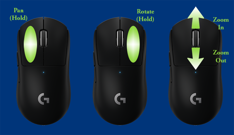
When first launching a viewer, you have full control to pan, rotate, zoom or click on an object/layer.

To pan or move around the map, hold left-click on your mouse while moving your mouse in the direction you wish to navigate.
To rotate or tilt the map, hold right-click on your mouse while moving the mouse.
To zoom in and out, use the scroll wheel on your mouse. Please note that some layers/datasets only appear at a certain zoom level.
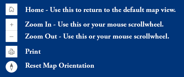
Each application has various toolbar buttons and icons. The top left toolbar features:

The icon in the bottom left of the map allows you to expand or collapse the legend and is useful if you wish to see more of the map.

The toolbar located in the top right of the map features:

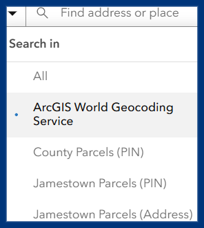
Note that there is an additional drop-down menu with options when searching. By default, the system will use the Esri ArcGIS World Geocoding Service however we have also implemented local data sets in order to allow you to search by address and/or parcel ID.

The icon in the bottom right of the map allows you to toggle layers on/off. A checkmark indicates the layer is currently being shown.
The other option in the bottom right is an option to switch between basemaps.

Popups
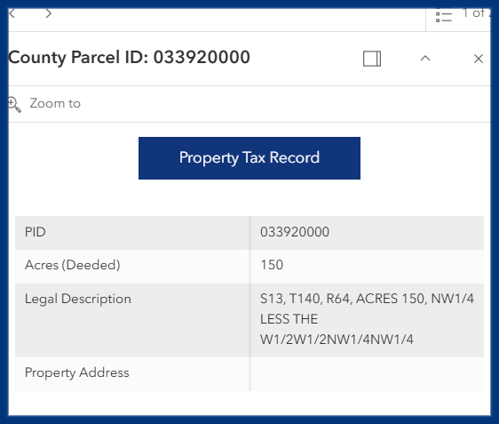
When navigating our viewers, many layers have popups enabled allowing you to see additional information. Simply left-click on any layer or object to view.
City and County parcels also include a button with a link to tax statement info.

Contact
- Information Technology Department
- Josh Smaage – Director Of Information Technology
- 511 2nd Ave SE Suite 102
Jamestown, ND 58401 - (701) 252-9035
- gis@stutsmancounty.gov


